

Green Belt in the Altmark
Altmark day trips
Green Belt in the Altmark: former border, nature and cycle routes
In short: The Green Belt (Grünes Band) is the strip along the former inner-German border where a refuge for rare animals and plants has grown since 1989. In Saxony-Anhalt it is 343 kilometres long and has been a National Natural Monument since 2019. In the Altmark it runs between the Drömling and the Elbe. Highlights are the once divided twin village of Böckwitz-Zicherie with its border museum, the razed village of Jahrsau near Salzwedel and the Four-States Border Cycle Route. From the country hotel “Zum Pottkuchen” in Kalbe (Milde) the Green Belt is about 30 to 40 minutes by car.
As of: November 2026
What is the Green Belt?
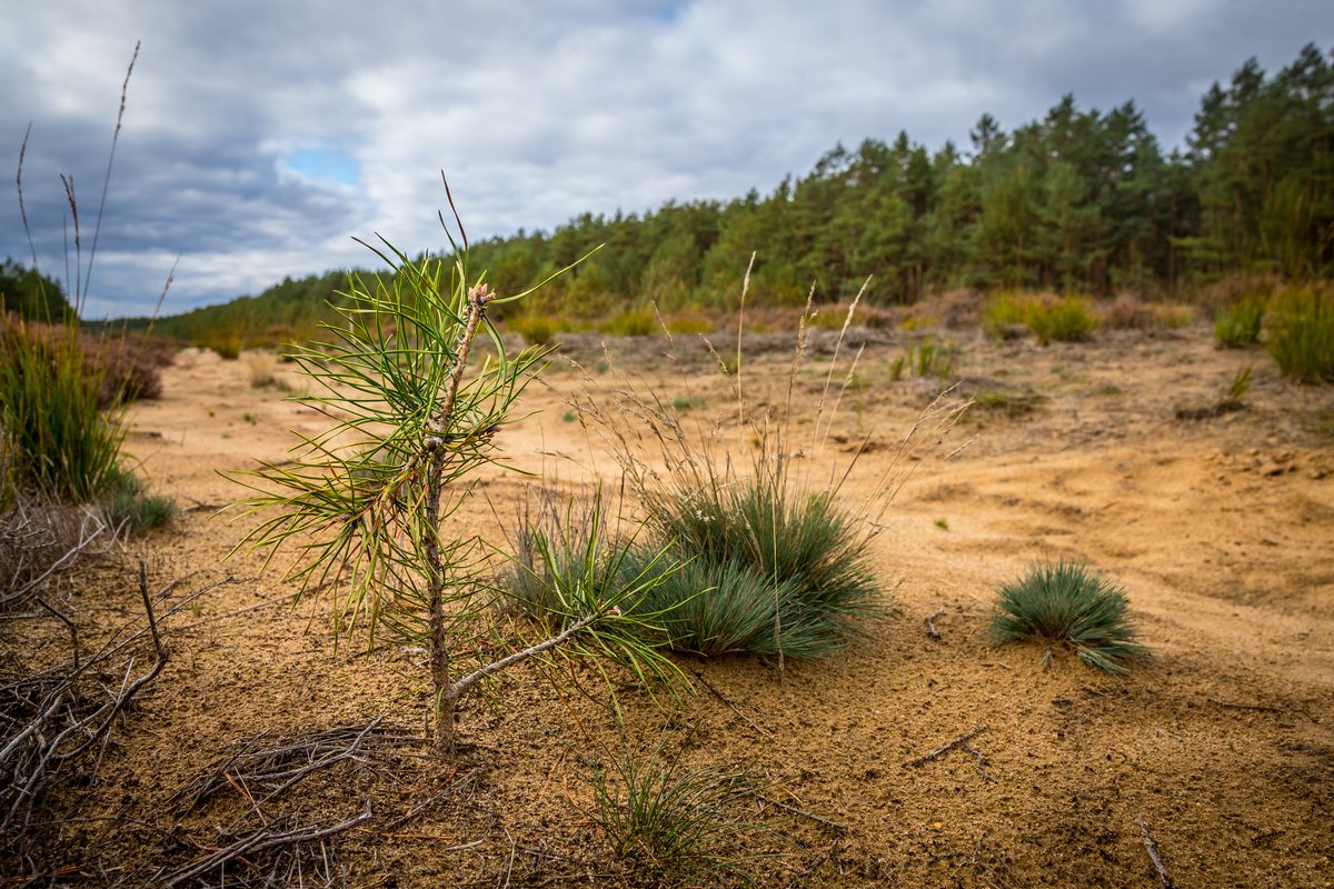
Where the inner-German border ran until 1989, a narrow strip remained almost untouched for decades. Today, as the Green Belt, it forms a chain of habitats from the Baltic Sea to the Vogtland – around 1,390 kilometres long. The section in Saxony-Anhalt is 343 kilometres long, covers 4,754 hectares and has been protected by law since November 2019 as the National Natural Monument “Grünes Band Sachsen-Anhalt – from death strip to lifeline”. The Green Belt combines nature and remembrance: alongside bogs, heaths and wet meadows, watchtowers, patrol roads and remains of the border fortifications have survived.
Where does the Green Belt run in the Altmark?
In the Altmark the Green Belt forms the border with Lower Saxony. In the Altmarkkreis Salzwedel it runs from the Drömling biosphere reserve in the south via Wiewohl and Dahrendorf to the north, then past Salzwedel into the Elbe valley. In the district of Stendal, the Stresow memorial and the Bömenzien watchtower near Seehausen recall the division. Kalbe (Milde) lies in the middle of the Altmark – from here you can easily reach the main sites along the Green Belt in a day.
Which places along the Green Belt can you visit in the Altmark?
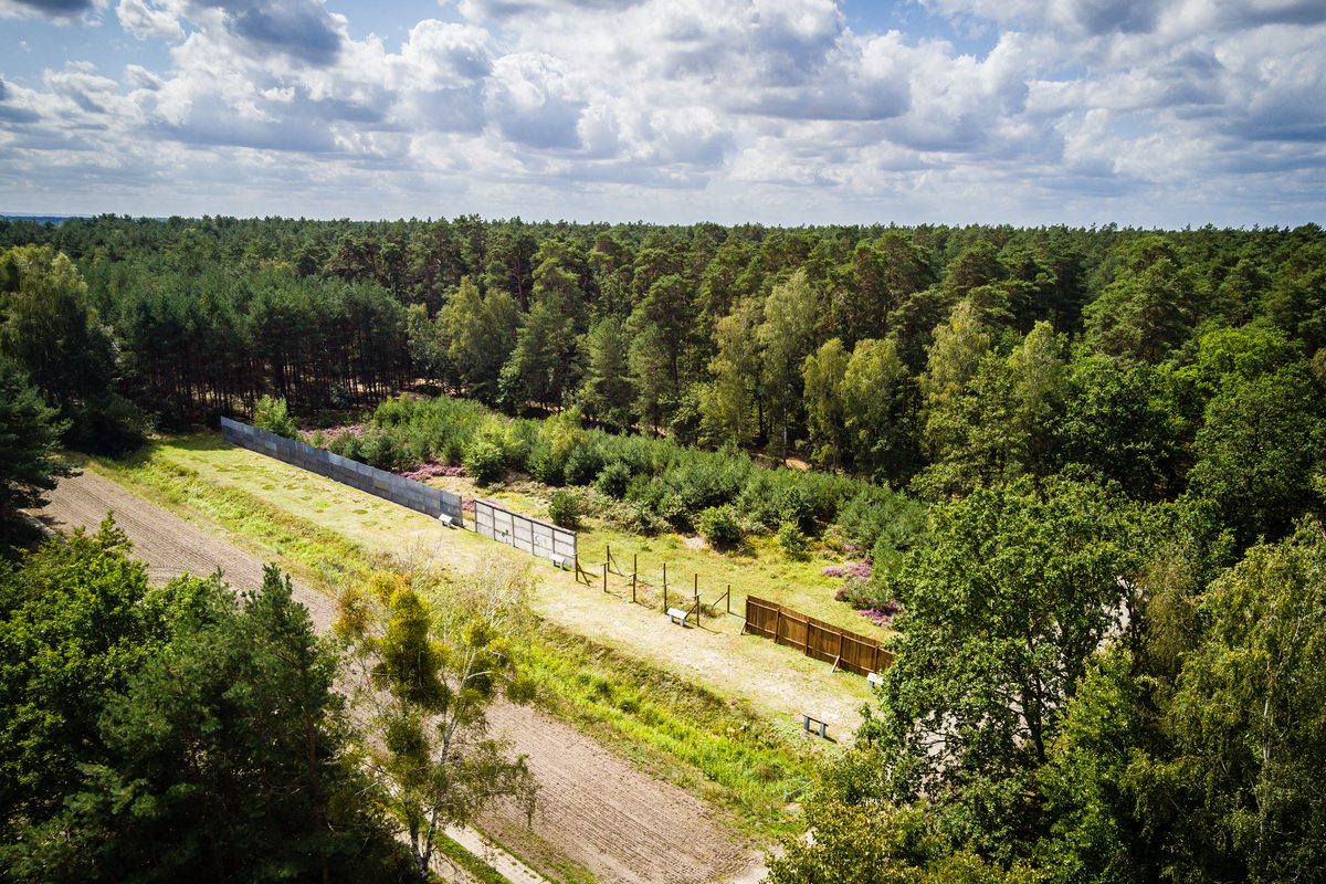
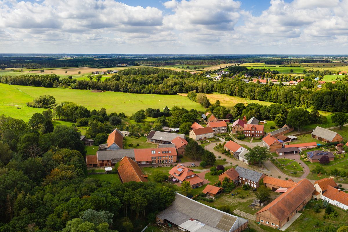
- Böckwitz-Zicherie and border museum: the border ran right through this twin village; the wall came down here on 18 November 1989. The museum in an old barn tells the story of the border and of life in the border zone, and a border trail explains the surviving installations. The museum opens only on certain days – please check before you go.
- Razed village of Jahrsau: a village near Salzwedel whose residents were forcibly resettled in 1952 in “Aktion Ungeziefer”. The houses were finally demolished in the 1970s; traces in the landscape still mark the site.
- Hoyersburg watchtower: a surviving GDR watchtower near Salzwedel, a stop on the Four-States Border Cycle Route, close to the Bürgerholz woods and salt meadows.
- Stresow memorial and Bömenzien watchtower: in the north of the Altmark near the Elbe: like Jahrsau, Stresow was cleared and levelled. The Bömenzien watchtower is freely accessible and can be viewed from outside.
- Breitenrode observation tower in the Drömling: on the southern edge of the Drömling near Oebisfelde. Since May 2026 a nature and culture trail of around 1.5 kilometres with nine stations on nature conservation and remembrance starts here.
Can you cycle the Green Belt?
Yes. The best-known route in the region is the Four-States Border Cycle Route (Vier-Länder-Grenzradweg): a circular route of around 170 kilometres where Saxony-Anhalt, Lower Saxony, Brandenburg and Mecklenburg-Western Pomerania meet. It is divided into six stages, has hardly any climbs and is suitable for families. Along the way are Salzwedel, the Hoyersburg watchtower, the razed village of Jahrsau and the Stresow memorial. It is part of the Iron Curtain Trail (EuroVelo 13), the European cycle route along the former Iron Curtain.
We are well prepared for cyclists: your bike is stored safely with us. Find out more on our page for cyclists. From Kalbe, the Milde-Biese-Aland route also crosses the Altmark.
What is a patrol road (Kolonnenweg)?
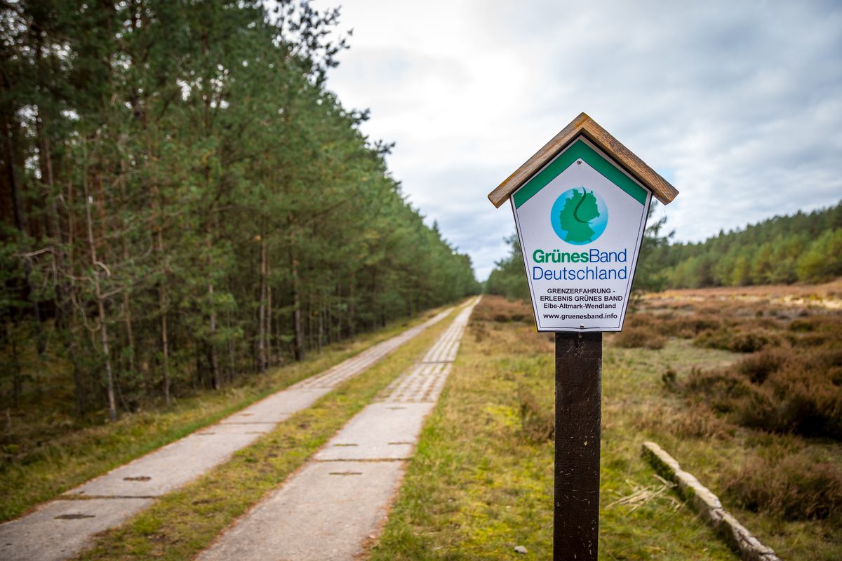
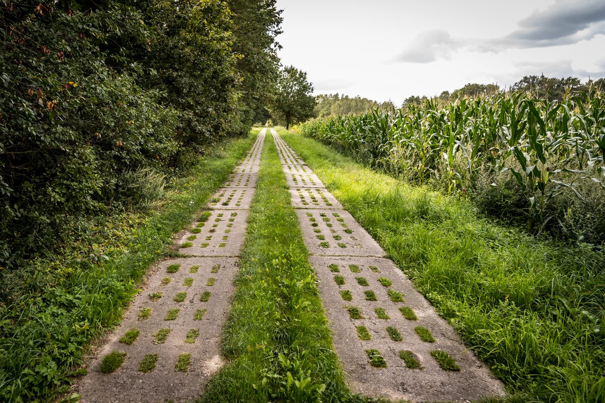
The Kolonnenweg was the track used by the GDR border troops behind the border fence. It consists of two lanes of perforated concrete slabs and still runs through the landscape in many places. It is good for walking, but rather bumpy for longer bike rides. It is often the clearest sign that you are on the Green Belt.
Day trips from Kalbe (Milde)
- South: Böckwitz and the Drömling: in the morning to Böckwitz-Zicherie (about 40 minutes by car) for the border trail, then into the Drömling near Klötze with cranes, storks and beavers.
- North: Salzwedel, Jahrsau and Arendsee: from Salzwedel (about 30 minutes by car) to the Hoyersburg watchtower and Jahrsau, in the afternoon to Lake Arendsee.
- West: Diesdorf: the Diesdorf open-air museum lies close to the former border and combines well with Böckwitz.
Hotel on the Green Belt in the Altmark? Stay in Kalbe (Milde)
If you are looking for a quiet place to stay on the Green Belt in the Altmark, the country hotel “Zum Pottkuchen” in Kalbe (Milde) offers eight rooms in a listed merchant’s house from 1775 – about 30 to 40 minutes by car away. From here you can also easily reach Salzwedel, Gardelegen, Stendal and Tangermünde. Find out more about our hotel in the Altmark and further destinations in our Altmark day trips.
Frequently asked questions about the Green Belt in the Altmark
What is the Green Belt?
The Green Belt is the strip along the former inner-German border. Today it is a chain of habitats and a landscape of remembrance from the Baltic Sea to the Vogtland.
How long is the Green Belt?
Around 1,390 kilometres in Germany. The section in Saxony-Anhalt is 343 kilometres long and has been a National Natural Monument since 2019.
Where does the Green Belt run in the Altmark?
Along the border with Lower Saxony: from the Drömling in the south via Wiewohl and Dahrendorf, past Salzwedel into the Elbe valley. In the district of Stendal, Stresow and Bömenzien recall the border.
Can you cycle the Green Belt?
Yes. In the Altmark the Four-States Border Cycle Route of around 170 kilometres is ideal; it is part of the Iron Curtain Trail (EuroVelo 13), has six stages and hardly any climbs.
Where can you see the former border in the Altmark?
For example in the twin village of Böckwitz-Zicherie with its border museum and trail, at the Hoyersburg watchtower and the razed village of Jahrsau near Salzwedel, and at the Stresow memorial and the Bömenzien watchtower.
What is a Kolonnenweg?
The former track of the GDR border troops, made of two lanes of perforated concrete slabs. It survives in many places along the Green Belt.
How far is the Green Belt from Kalbe (Milde)?
Böckwitz-Zicherie is about 40 minutes and Salzwedel about 30 minutes by car from the country hotel “Zum Pottkuchen”.
Where to stay on a trip to the Green Belt?
If you want to combine the Green Belt with other destinations in the Altmark, our country hotel “Zum Pottkuchen” in Kalbe (Milde) is a central base – about 30 to 40 minutes by car away. Enquire about a room now.
Header image: Border wall and fence with flowering heather near Böckwitz. Photo: © Steffen Lehmann / IMG Sachsen-Anhalt mbH
 The country hotel “Zum Pottkuchen” is a small, owner-run hotel in the old town of Kalbe (Milde) – a quiet base for trips along the Green Belt, into the Drömling and across the whole Altmark. Eight rooms, breakfast in-house, safe bike storage and free 1 Gbit/s fibre internet. View our rooms or enquire directly.

